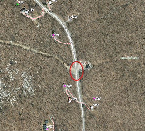
RUTLAND—The Rutland Regional Planning Commission (RRPC) is developing a regional map of the public infrastructure most at risk for flood and erosion. Public infrastructure of interest includes: transfer stations, former landfill sites, water treatment facilities, town halls, and fire stations, as well as sections of road that have defined risks associated with them.
These “hot spots” will be determined using the following existing data: river corridors, municipal facilities (such as waste water treatment facilities and town halls), source protection areas, fluvial erosion hazard (FEH) zones, FEMA flood hazards, local hazard mitigation plan information, and flooding and erosion information derived from maps showing the areas of local concern.
The second phase of the project will be a public workshop hosted by the RRPC to share the final hot spot map with town officials, road foremen, and the watershed coordinator. Public infrastructure vulnerable to flooding and erosion will be ranked in order of risk on the map and will help towns determine future flood and erosion mitigation project priorities.
At the workshop, the RRPC also will provide project recommendations and suggestions for funding resources to the towns for mitigating these hot spots. The completed map will be integrated into local hazard mitigation plans and may provide a basis for future grant applications.
The Rutland Regional Planning Commission is one of 11 organizations across Vermont to share more than $40,000 in funding from the State of Vermont Department of Environmental Conservation to conduct water quality planning activities.