
Editor’s note: Mark Bushnell is a Vermont journalist and historian. He is the author of “Hidden History of Vermont” and “It Happened in Vermont.” This story was first published as a “Then Again” feature at VTDigger.org.
To get a deeper understanding of Vermont’s history, you might want to go deeper, to the literal bedrock of the state. And you might want to look further back in time than most people can quite imagine. For a moment, stop thinking of time in decades, centuries or even mere millennia. Think instead in millions and sometimes even billions of years.
The story of Vermont’s buried stone core might seem irrelevant to understanding the state’s quite recent past, the last, say, several hundred years, but the rocks beneath our feet have always dictated where and how Vermonters have lived.
“Civilization exists by geological consent …” as famed historian Will Durant reportedly once said, “… subject to change without notice,” the quote ends, on a darker note. (But let’s focus on the first part.)
Mountains are born
You could begin the geological story of Vermont 4.6 billion years ago with the creation of Earth. But let’s skip the first two-thirds of our planet’s history and fast-forward to a mere 1.4 billion years ago. That’s when the oldest rocks that still exist in Vermont were formed during what geologists call the Grenville Orogeny. (“Orogeny” combines two Greek words meaning “mountain” and “creation.”)
The Grenville Orogeny only makes sense if you know a little about the tectonic plate theory of geology, which says that all the world’s major landmasses currently sit on about a dozen massive continental plates — we don’t know how many plates existed in the distant past. These plates are in constant motion and occasionally collide with one another. The movement is incredibly slow — only a few inches a year — but dramatic when viewed over the time periods in which geologists think.
More than a billion years ago, two landmasses, one containing what is now Vermont, collided. The impact fractured the edge of the Vermont landmass and thrust parts of it upward, creating a great mountain range, sort of a precursor of the Green Mountains.
The mountains kept growing, though they were eroding at the same time. Eventually the erosion outstripped the growth, and the mountains began slowly to shrink until, after 300 million years, the land was flat and sea level again. Rocks created during the Grenville Orogeny, however, can still be found in Vermont in the Green Mountains in the town of Ripton and from south of Route 4 to near the Massachusetts border.
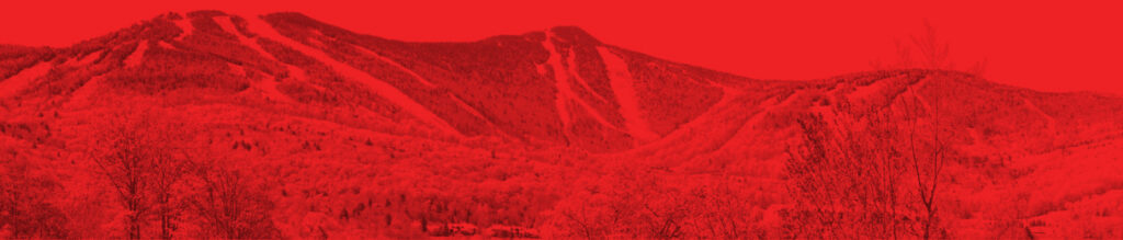
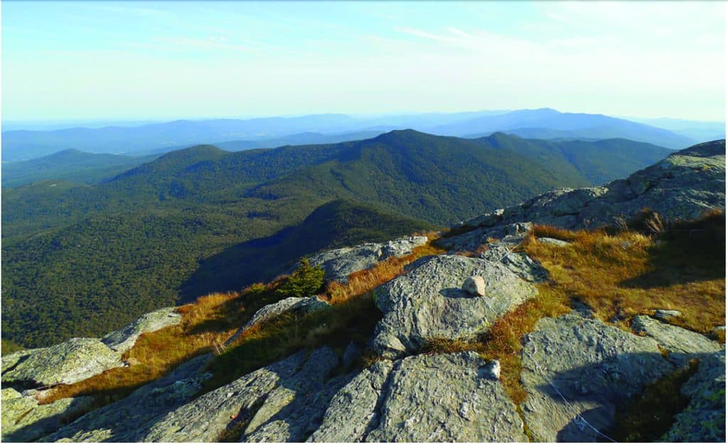
The next major geological event was what’s known as the Taconic Orogeny. About 450 million years ago, the tectonic plate containing proto-North America moved toward a neighboring plate, as a pre-Atlantic Ocean, known as the Iapetus Ocean, began to close. The impact forced the land, as well as sediments that had been on the ocean floor, upward and formed another set of mountains. Most of these East Coast mountains have since eroded away, but some remain, including Vermont’s iconic Green Mountains and the Taconic Mountains in the state’s southwest corner.
But the earth-shaking changes didn’t end here. The Green Mountains were reshaped about 100 million years later during the Acadian Orogeny. During that mountain-forming event, magma surged through cracks in proto-North America and created the granite peaks of northeastern Vermont and New Hampshire.
The basic layout of Vermont in terms of its mountains and valleys was probably established by about 150 million years ago. Since then, Vermont’s geology has mostly been a story of erosion, which has been hastened in more recent times by glaciers.
For simplicity’s sake, Vermont’s geography is usually divided into six zones: the Champlain Lowlands, a fertile zone bordering Lake Champlain; the Green Mountains, peaks made largely of metamorphic rocks (those transformed by high heat and pressure) that form the spine of Vermont; the Taconic Mountains, smaller peaks in Southwestern Vermont composed mostly of metamorphic rocks; the Valley of Vermont, a narrow plain squeezed between the Green Mountains and the Taconics; the Vermont Piedmont, the foothills of the Green Mountains running the length of the state along its eastern edge; and the Northeastern Highlands, also known as the Northeast Kingdom, geologically related to the White Mountains, since both were created by magma from the Earth’s core surging to the surface and forming granite.
But in more recent times, Vermont’s geology has been shaped more by ice than by fire. The region has experienced four glacial eras over the last 1.8 million years. The most recent reached its maximum extent about 25,000 years ago, when an ice sheet covered Vermont and reached as far south as Long Island.
Ice, some of it about a mile thick, still covered Vermont 15,000 years ago. The last of the ice was gone from the state by about 13,000 years ago. During its passage, the ice had transformed the land. Moving south, the ice had smoothed the north faces of Vermont’s mountains while plucking rocks from the south-facing slopes. These rock formations, referred to as roche moutonnée, are still visible today, most notably in the profile of Camel’s Hump.
Two kinds of farmers
The glaciers gave Vermont two kinds of farmers. Hill farmers are commonly thought of as a hardscrabble lot, who harvest more rocks from their fields than crops. Glaciers left behind these rocks, which are part of what geologists call glacial till. As the glaciers melted, they left behind the debris they had been pushing along — large boulders, gravel, clay, sand and silt. Most of the rocks got deposited in the uplands.
Valley farmers are typically more prosperous, for reasons directly relating to how glaciers once blocked valley drainages. In some places, the waters were held in place long enough for the finest sediment to fall out of suspension and create fertile, workable clay soils, which are more easily farmed.
Once the glaciers melted, watercourses often found new ways to drain, cutting down to steep sections of bedrock and producing waterfalls, which have attracted people ever since humans first populated Vermont, starting about 12,000 years ago, according to former State Geologist Laurence Becker.
Archeologists believe waterfalls were important places for Native Americans for both sacred and practical reasons. The falls were productive fishing areas and served as community gathering spots when the fish were running, says former State Archaeologist Giovanna Peebles. Waterfalls also served as valuable meeting places because they were distinctive geographical features that were widely known.
Later, European settlers flocked to waterfalls because they offered hydro-mechanical power, notes Becker; that is, they were good sites to build mills, the factories of their day. No wonder so many towns have the word “falls” in their names.
Where water travels is an indicator of where humans will travel. Native Americans often followed rivers and streams for navigation and because water follows the path of least resistance. When they arrived, Europeans followed footpaths set down by Native Americans along waterways and eventually widened them. Today we know these routes as national highways, such as I-89; state highways, like Route 2; and numerous smaller roads.
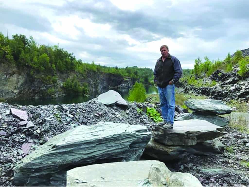
The various mountain-creating events that Vermont underwent have determined how we use the land. Molten rock formed into granite in Barre, hence the granite industry there. Marine organisms and shells from an ancient ocean formed into limestone, which under immense heat and pressure became marble, leading to a marble industry centered in Proctor. Nearby, in Fair Haven and surrounding towns, clay turned to shale, which heat and pressure turned into slate, and another industry was born. For a time, the same was true for copper around Vershire and asbestos on Belvidere Mountain in Eden and Lowell.
Geology also helped dictate the state’s borders; Lake Champlain to the west and the Connecticut River to the east are obvious natural boundaries. In contrast, the north and south boundaries were purely political creations. Geology also made Lake Champlain flow north, which has caused parts of our region, from Native American times through early statehood, to be more connected with Canada than with areas to the south.
Of course, not every event in Vermont’s history can be tied to its geology. But it is a link worth exploring. As with any form of prospecting, the deeper you look, the more you find.